Banda Naira, November 2012. This is the first in a multi-part series chronicling Conservancy scientist Alison Green’s trip with the Coral Triangle Center to conduct a rapid marine assessment in the Banda Sea.
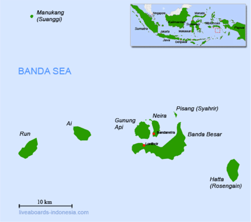
 Last week I traveled to the Banda Islands, a remote oceanic archipelago in the Banda Sea in the heart of the Coral Triangle. This 40km-long stretch of small volcanic islands rises out of very deep water that extends four to six kilometers beneath the surface.
This archipelago was once known as the Spice Islands, since it was the only source of nutmeg and mace for Europeans until the mid-19th century. These days the islands are becoming a popular destination for scuba divers.
In 2002, a rapid ecological survey led by The Nature Conservancy found that the Banda Islands are an area of high conservation value because of their spectacular landscape, rich history, high biodiversity, unique geography and geology, and excellent marine habitat conditions. While some of the reef fish stocks showed signs of exploitation, the survey reported that the low human population density and fisheries focus on pelagic tuna provide an excellent opportunity forcoral reef conservation.
In 2009, the Banda Sea (including the Banda Islands) was identified as one of the highest marine conservation priorities in Indonesia based on its high diversity of habitats and coral reef species, strategic role in connectivity (based on current patterns), significant role in sea turtle life cycles, and significance to highly endangered oceanic cetaceans (including blue whales).
Since the Banda Sea is a very deep basin, it has also provided an important refuge for coral reef species during past periods of low sea level, and it may play a similar role in future if (as predicted) sea temperatures increase less here than in other areas. Consequently, the Banda Sea is considered one of most important areas for expanding the coverage of resilient networks of Marine Protected Areas (MPAs) in Indonesia.
At present, there is only one small MPA in the area, located between the islands of Banda Besar, Gunang Api and Neira (see map above. Local communities and other stakeholders are interested in building on this MPA to develop an expanded MPA network that will provide benefits to both people and nature by ensuring the sustainability of local industries (fisheries and tourism), protecting biodiversity and allowing for adaptation to climate change.
Last week, I traveled to the Banda Islands to help the Coral Triangle Center conduct a second rapid marine assessment, which focused on collecting the social and ecological information required to design a resilient network of MPAs for the area.
The survey team was comprised of a multidisciplinary group of predominately Indonesian scientists, government officials and local stakeholders. Stay tuned over the next few days as we share the results of our survey—and the implications for MPA network design—with you.
Learn more about the Conservancy’s involvement in the game-changing Coral Triangle Initiative on Coral Reefs, Fisheries and Food Security..
Learn more about the Conservancy’s involvement in the game-changing Coral Triangle Initiative on Coral Reefs, Fisheries and Food Security..
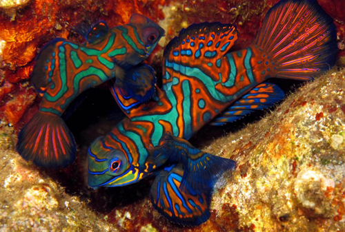
(Image 1: Mandarin Fish, Banda Islands. Image credit: Marthen Welly. Image 2: Map of Banda Islands. Image credit: Pt. Vifa Mandiri Pratama.)
Source : http://blog.nature.org/2012/11/expedition-to-the-spice-islands-a-rapid-marine-assessment/01_map/
Tidak ada komentar:
Posting Komentar